Decoding the Spatial Intelligence Revolution: A Machine Learning Odyssey
Prelude to a Technological Transformation
Imagine standing at the intersection of geography and artificial intelligence, where every pixel, coordinate, and data point tells a complex story of interconnected systems. This is the realm of spatial machine learning—a domain where technology transcends traditional boundaries and reimagines our understanding of the world.
My journey into spatial intelligence began not in a sterile laboratory, but amid the vibrant landscapes that sparked my curiosity about how technology could decode environmental complexity. Each geographical feature, from mountain ranges to urban networks, represents a narrative waiting to be understood through advanced computational techniques.
The Evolutionary Landscape of Spatial Data
Spatial data has undergone a remarkable metamorphosis. What once required extensive manual mapping and interpretation can now be processed, analyzed, and predicted with unprecedented precision. Machine learning algorithms have become the cartographers of the digital age, creating intricate maps of knowledge that extend far beyond traditional geographical representations.
Foundations of Spatial Intelligence
At its core, spatial data represents more than mere coordinates. It encapsulates intricate relationships between physical environments, human activities, and dynamic ecological systems. Each data point carries a multidimensional signature—geometric representations, temporal dynamics, and contextual attributes that reveal complex interactions.
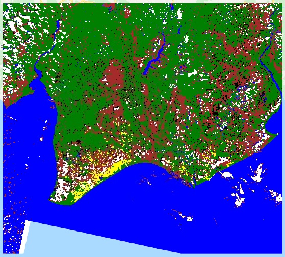
Consider a satellite image of a forest. Traditional analysis might identify tree cover, but machine learning transforms this perspective. By integrating spectral signatures, temporal changes, and ecological indicators, we can now predict forest health, track biodiversity shifts, and model climate change impacts with remarkable accuracy.
Machine Learning: Redefining Spatial Analysis
The transition from static geographical information systems to dynamic, predictive spatial intelligence marks a profound technological revolution. Machine learning algorithms do not merely interpret spatial data; they learn from its inherent complexity, uncovering patterns invisible to human perception.
Algorithmic Symphonies of Spatial Understanding
Supervised learning techniques have become sophisticated spatial translators. Regression models predict environmental transformations, while classification algorithms map land use transitions with unprecedented detail. Support Vector Machines navigate complex spatial classifications, creating nuanced representations of geographical phenomena.
Unsupervised learning methods introduce another dimension of spatial comprehension. Clustering algorithms recognize intricate spatial patterns, revealing hidden relationships between geographical features. Density-based techniques map population distributions, urban growth dynamics, and ecological migrations with remarkable precision.
Technological Frontiers: Beyond Traditional Boundaries
Deep learning innovations have exponentially expanded spatial intelligence capabilities. Convolutional Neural Networks analyze satellite imagery with human-like perceptiveness, detecting subtle environmental changes. Graph Neural Networks model interconnected spatial systems, revealing complex ecological and urban interactions.
Real-World Transformation Narratives
Environmental monitoring represents a compelling application landscape. Machine learning enables scientists to track deforestation, predict climate change impacts, and model biodiversity shifts with unprecedented accuracy. Each algorithm becomes a digital sentinel, watching global ecological dynamics in real-time.
Urban planning has similarly undergone a technological renaissance. Machine learning supports infrastructure optimization, transportation network design, and resource allocation strategies. Cities are no longer static entities but dynamic, predictive ecosystems responsive to computational intelligence.
Computational Architecture: The Technological Backbone
High-performance computing, advanced sensor networks, and cloud platforms have become the infrastructure supporting spatial machine learning. Edge computing architectures enable real-time processing, transforming how we collect, analyze, and interpret geographical information.
Ethical Considerations in Spatial Intelligence
As technological capabilities expand, ethical frameworks become paramount. Data privacy, algorithmic fairness, and transparent decision-making processes must guide spatial machine learning development. We are not just creating algorithms; we are crafting responsible technological narratives.
Navigating Implementation Challenges
Implementing spatial machine learning requires sophisticated strategies. Data preprocessing, feature engineering, and model validation become critical components of a comprehensive approach. Continuous learning models adapt to evolving geographical dynamics, ensuring ongoing relevance and accuracy.
The Human Element in Technological Evolution
Despite advanced computational capabilities, human expertise remains irreplaceable. Machine learning algorithms are powerful tools, but they require domain knowledge, contextual understanding, and interdisciplinary collaboration to unlock their full potential.
Looking Forward: A Visionary Perspective
The future of spatial intelligence lies in collaborative, integrative approaches. By combining advanced machine learning techniques with domain expertise across environmental, social, and technological domains, we can develop more sophisticated, responsive solutions to global challenges.
Invitation to Exploration
For those captivated by this technological frontier, the journey has just begun. Explore specialized geospatial machine learning courses, engage with open-source platforms, and contribute to research initiatives that push the boundaries of spatial understanding.
As we stand at this technological crossroads, spatial machine learning represents more than a computational technique—it‘s a transformative lens through which we can reimagine our relationship with the planet, decode complex systems, and develop more sustainable, intelligent approaches to global challenges.
The map is no longer just a representation—it‘s a living, predictive narrative of our interconnected world.