Implementing Geospatial Data Analysis: A Transformative Journey Through Spatial Intelligence
The Uncharted Territories of Spatial Understanding
Imagine standing at the intersection of technology and geography, where every point on Earth tells a story waiting to be decoded. Geospatial data analysis isn‘t just about mapping coordinates; it‘s about understanding the complex narratives woven into our planet‘s intricate spatial fabric.
As someone who has spent years navigating the fascinating world of spatial intelligence, I‘ve witnessed how geospatial technologies have revolutionized our understanding of complex systems. From urban planning to environmental conservation, from public health to climate research, spatial analysis has become the lens through which we comprehend our increasingly interconnected world.
The Evolution of Spatial Intelligence
The journey of geospatial data analysis is a testament to human curiosity and technological innovation. What began as rudimentary cartography has transformed into a sophisticated discipline combining advanced mathematics, computer science, and domain-specific expertise.
In the early days, spatial analysis meant manually plotting points on paper maps, laboriously tracking patterns and relationships. Today, we harness powerful computational frameworks that can process millions of spatial data points in milliseconds, revealing insights that were once unimaginable.
Technological Foundations of Modern Spatial Analysis
Mathematical Underpinnings
At the heart of geospatial analysis lies a complex mathematical framework. Spatial statistics, topology, and advanced geometric algorithms form the fundamental language of this discipline. Techniques like kriging interpolation, spatial regression, and topological transformations allow us to translate raw geographic data into meaningful insights.
Consider spatial autocorrelation – a concept that reveals how geographic proximity influences data characteristics. This isn‘t just about measuring distances; it‘s about understanding the intricate relationships between spatial entities, revealing patterns that transcend traditional analytical boundaries.
Computational Ecosystems
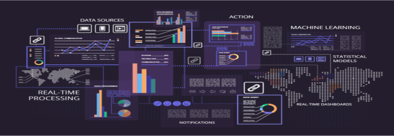
Modern geospatial analysis relies on robust computational ecosystems. Python libraries like GeoPandas and Shapely have democratized spatial data processing, enabling researchers and practitioners to perform complex spatial computations with remarkable ease.
Distributed computing frameworks and cloud-based spatial processing platforms have further expanded our analytical capabilities. We‘re no longer constrained by local computational resources; entire continents can be analyzed simultaneously, revealing global patterns and local nuances.
Machine Learning: Transforming Spatial Intelligence
Machine learning has emerged as a game-changing technology in geospatial analysis. Neural networks and deep learning algorithms can now:
- Predict urban growth patterns
- Detect environmental changes
- Forecast disease spread
- Optimize resource allocation
These aren‘t mere predictions; they‘re sophisticated models that learn from complex spatial interactions, continuously refining their understanding of geographic systems.
Predictive Spatial Modeling
Imagine an algorithm that can anticipate urban development trends by analyzing historical land use patterns, transportation networks, and socioeconomic data. Such predictive models don‘t just extrapolate; they understand the complex, non-linear relationships that shape our geographic landscapes.
Real-World Impact and Transformative Applications
Environmental Conservation
Geospatial technologies have become critical in understanding and mitigating environmental challenges. Satellite imagery combined with machine learning algorithms can track deforestation, monitor coral reef health, and predict wildfire risks with unprecedented accuracy.
Public Health Surveillance
During the COVID-19 pandemic, geospatial analysis played a crucial role in tracking disease spread, identifying high-risk areas, and optimizing resource allocation. These technologies transformed our understanding of epidemiological dynamics, saving countless lives.
Urban Planning and Smart Cities
Cities are becoming living, breathing computational systems. Geospatial analysis helps urban planners optimize transportation networks, design sustainable infrastructure, and create more livable urban environments.
Ethical Considerations and Future Challenges
As our spatial analysis capabilities grow, so do the ethical considerations. Privacy, data sovereignty, and algorithmic bias are critical challenges we must address.
Responsible geospatial technology development requires:
- Transparent algorithmic design
- Diverse and representative datasets
- Robust privacy protection mechanisms
- Continuous ethical evaluation
Emerging Frontiers: Beyond Traditional Boundaries
Quantum Computing and Spatial Intelligence
Quantum computing represents the next frontier in geospatial analysis. These advanced computational systems promise to solve complex spatial optimization problems that are currently computationally intractable.
Federated Learning in Spatial Domains
Imagine a global network of spatial intelligence, where institutions can collaboratively develop models without compromising data privacy. Federated learning techniques are making this vision a reality.
Personal Reflection: The Human Element
Technology is ultimately a human story. Each spatial data point represents a human experience, a moment in time, a connection waiting to be understood.
As we continue pushing the boundaries of geospatial analysis, we‘re not just processing data – we‘re uncovering the intricate stories that connect us to our planet and each other.
Conclusion: A Continuous Journey of Discovery
Geospatial data analysis is more than a technological discipline; it‘s a lens through which we understand our world‘s complexity. As technologies evolve and our computational capabilities expand, we stand on the brink of unprecedented spatial insights.
The future of geospatial analysis is not about predicting the world – it‘s about understanding it, respecting it, and creating more informed, sustainable solutions for our shared global challenges.
Our journey has only just begun.