Spatial Interpolation Unveiled: A Journey Through Predictive Geospatial Intelligence
The Unexpected Path to Understanding Space
Imagine standing in a vast landscape, surrounded by scattered measurement points, each whispering fragments of a complex spatial story. This is where spatial interpolation transforms from a mere statistical technique into an art of understanding hidden geographical narratives.
My First Encounter with Spatial Mystery
Years ago, as a young researcher tracking environmental changes, I encountered a perplexing challenge. How could we understand the intricate patterns of temperature, rainfall, and ecosystem dynamics when our data points were frustratingly sparse?
The answer lay in spatial interpolation – a powerful technique that would become my professional passion and scientific companion.
Decoding the Spatial Puzzle: What Makes Interpolation Magical?
Spatial interpolation isn‘t just about connecting dots on a map. It‘s a sophisticated dance of mathematics, statistics, and geographical understanding. At its core, this technique allows us to predict unknown values in geographic spaces by intelligently analyzing known data points.
The Mathematical Symphony of Prediction
Consider the complex interactions happening beneath every square meter of landscape. Temperature doesn‘t abruptly change; it transitions smoothly. Rainfall patterns emerge through intricate geographical relationships. Spatial interpolation captures these nuanced transitions.
Mathematical Foundations
The fundamental equation driving spatial interpolation can be expressed as:
[Z(s) = \sum{i=1}^{n} \lambda_i Z(s_i)]Where:
- [Z(s_0)] represents the predicted value at an unsampled location
- [Z(s_i)] represents known values at sampled locations
- [\lambda_i] represents weights assigned to each known point
This seemingly simple equation encapsulates profound predictive capabilities.
Evolutionary Journey of Spatial Prediction Techniques
From Manual Mapping to Computational Intelligence
Historically, geographers and scientists manually interpolated data, drawing contour lines and making educated guesses. Today, advanced computational techniques transform this process, integrating machine learning, statistical modeling, and high-performance computing.
Computational Revolution
Modern spatial interpolation leverages:
- Advanced statistical algorithms
- Machine learning models
- High-dimensional data processing
- Real-time computational frameworks
Interpolation Techniques: A Deep Dive
Nearest Neighbor: The Simplistic Approach
Nearest neighbor interpolation represents the most straightforward method. It assigns an unknown point‘s value based on its closest known point. While computationally efficient, it lacks nuanced understanding of spatial complexity.
Inverse Distance Weighting: Proximity-Based Prediction
Inverse Distance Weighting (IDW) introduces a more sophisticated approach. By assigning weights based on distance, it creates a more nuanced prediction surface.
The IDW formula elegantly captures this concept:
[Z = \frac{\sum{i=1}^{n} \frac{Z_i}{di^p}}{\sum{i=1}^{n} \frac{1}{d_i^p}}]Where:
- [Z_0] is the predicted value
- [Z_i] represents known point values
- [d_i] represents distances
- [p] is a power parameter controlling weight distribution
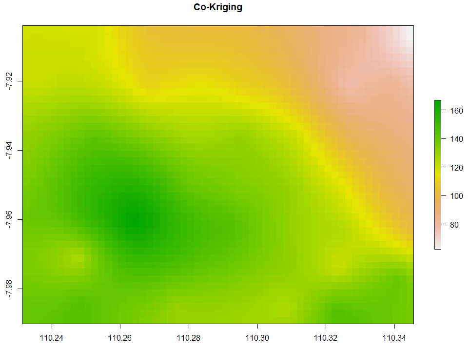
Kriging: The Geostatistical Maestro
Kriging represents the pinnacle of spatial interpolation techniques. Unlike simpler methods, it considers spatial autocorrelation, providing not just predictions but also uncertainty estimates.
Machine Learning: Transforming Spatial Understanding
Neural Networks and Spatial Prediction
Contemporary machine learning models are revolutionizing spatial interpolation. Convolutional neural networks can now capture complex, non-linear spatial relationships that traditional statistical methods struggle to model.
Deep Learning Advantages
- Handle high-dimensional spatial data
- Capture complex non-linear patterns
- Provide probabilistic predictions
- Integrate multiple data sources
Real-World Applications: Beyond Academic Curiosity
Spatial interpolation isn‘t confined to academic research. It drives critical decision-making across numerous domains:
Environmental Monitoring
Climate scientists use interpolation to understand temperature variations, predict ecosystem changes, and model environmental transformations.
Urban Planning
City planners leverage spatial prediction to optimize infrastructure, understand population dynamics, and design resilient urban environments.
Agricultural Innovation
Precision agriculture relies on spatial interpolation to optimize crop yields, understand soil variations, and implement targeted farming strategies.
Ethical Considerations in Spatial Prediction
As our predictive capabilities advance, ethical considerations become paramount. How do we ensure responsible use of spatial interpolation techniques?
Key ethical dimensions include:
- Data privacy
- Prediction transparency
- Avoiding algorithmic biases
- Responsible technological deployment
The Future of Spatial Intelligence
Emerging technologies promise unprecedented spatial understanding. Quantum computing, advanced machine learning, and real-time sensor networks will revolutionize how we perceive and predict geographical patterns.
Predictive Frontiers
- Hyper-local environmental modeling
- Real-time disaster response systems
- Personalized geographical intelligence
- Integrated multi-source data prediction
Conclusion: A Personal Reflection
Spatial interpolation represents more than a technical process. It‘s a testament to human curiosity, our desire to understand complex systems, and our ability to transform limited information into comprehensive knowledge.
As you embark on your spatial interpolation journey, remember: every data point tells a story, and with the right techniques, we can listen to landscapes whispering their hidden secrets.
Your Spatial Exploration Begins Now
Embrace the complexity, challenge your assumptions, and let spatial intelligence guide your understanding of our intricate world.