Illuminating the World: The Fascinating Science and Applications of LIDAR Technology
In an era where technology is rapidly reshaping our understanding and interaction with the world, LIDAR (Light Detection and Ranging) stands out as a groundbreaking innovation. This sophisticated remote sensing method is revolutionizing industries ranging from autonomous vehicles to archaeology, offering unprecedented precision in mapping and measurement. Let's embark on an illuminating journey to explore the inner workings, applications, and future potential of LIDAR technology.
The Fundamentals of LIDAR: Painting the World with Light
At its core, LIDAR is an active remote sensing technology that uses light to measure distances and create detailed three-dimensional maps of the environment. Unlike passive sensing technologies that rely on ambient light, LIDAR actively emits laser pulses and measures the time it takes for the light to return after hitting an object. This simple principle, combined with cutting-edge hardware and software, allows LIDAR systems to create astonishingly accurate 3D representations of the world around us.
The Anatomy of a LIDAR System
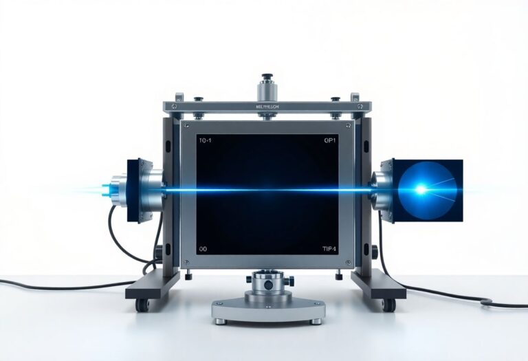
A typical LIDAR system consists of several key components working in harmony:
-
Laser Emitter: The heart of the system, emitting rapid pulses of laser light, typically in the near-infrared spectrum.
-
Receiver: A sensitive photodetector that captures the reflected light pulses.
-
Scanning Mechanism: Often a rotating mirror or solid-state device that directs the laser pulses across a wide field of view.
-
GPS Receiver: Provides precise geolocation data for each measurement.
-
Inertial Measurement Unit (IMU): Tracks the orientation and movement of the LIDAR unit, crucial for mobile applications.
-
Data Processing Unit: Converts raw time-of-flight measurements into usable 3D point cloud data.
The Physics Behind the Light
LIDAR's functionality is grounded in fundamental physics principles. The technology leverages the constant speed of light, which travels at approximately 299,792,458 meters per second in a vacuum. In air, this speed is slightly reduced, but the difference is often negligible for most LIDAR applications.
The distance to an object is calculated using the "time of flight" principle. By measuring the time it takes for a light pulse to travel to an object and back, the system can determine the distance using the formula:
Distance = (Speed of Light × Time of Flight) / 2
The division by two accounts for the round trip of the light pulse.
Different LIDAR systems employ various wavelengths of light depending on their specific application. Terrestrial LIDAR systems often use near-infrared light (905 nm or 1550 nm), which is invisible to the human eye but effective for measuring distances to solid objects. Bathymetric LIDAR, used for measuring water depths, typically utilizes green light (532 nm) due to its superior water penetration capabilities.
LIDAR in Action: Diverse Applications Across Industries
The versatility of LIDAR technology has led to its adoption across a wide range of fields, each harnessing its capabilities in unique ways.
Autonomous Vehicles: Seeing the Road Ahead
In the realm of autonomous vehicles, LIDAR serves as the eyes of the car, creating real-time, high-resolution 3D maps of the surrounding environment. These systems can detect obstacles, other vehicles, pedestrians, and road features with centimeter-level accuracy, even in low-light conditions where traditional cameras might struggle.
For instance, Waymo's self-driving cars use a custom-built LIDAR system that can detect objects up to 300 meters away, providing a comprehensive view of the vehicle's surroundings. This level of perception is crucial for safe navigation in complex urban environments.
Forestry and Conservation: Seeing the Forest and the Trees
LIDAR has become an indispensable tool in forestry and conservation efforts. Its ability to penetrate tree canopies allows researchers to measure forest structure, estimate biomass, and track changes over time with unprecedented accuracy.
A study published in the journal "Remote Sensing of Environment" demonstrated how airborne LIDAR could estimate tree heights with an accuracy of 0.5 meters, even in dense tropical forests. This capability is invaluable for monitoring deforestation, assessing carbon sequestration, and managing forest resources sustainably.
Archaeology: Unearthing Hidden Histories
LIDAR has revolutionized archaeology by revealing hidden structures beneath dense vegetation. In 2018, LIDAR technology helped archaeologists discover more than 60,000 previously unknown Maya structures in Guatemala, including houses, palaces, and elevated highways. This groundbreaking find has transformed our understanding of Maya civilization, suggesting it was far more complex and interconnected than previously thought.
Urban Planning and Disaster Management
Cities worldwide are leveraging LIDAR to create detailed 3D models for urban planning, flood risk assessment, and infrastructure management. For example, the city of New York used LIDAR data to create a comprehensive 3D map of the city, accurate to within 6 inches, which has been crucial for everything from emergency response planning to solar energy potential assessment.
In disaster management, LIDAR plays a vital role in assessing damage and planning recovery efforts. After Hurricane Katrina, LIDAR was used to create precise elevation maps of New Orleans, helping to identify areas at risk of flooding and guiding reconstruction efforts.
The Evolution of LIDAR: From Bulky to Miniature
As LIDAR technology advances, we're witnessing a trend towards miniaturization and integration, opening up new possibilities for widespread adoption.
Solid-State LIDAR: A Quantum Leap
Traditional mechanical LIDAR systems rely on rotating components to scan the environment. However, solid-state LIDAR systems, which have no moving parts, are emerging as a game-changer. Companies like Velodyne and Quanergy are at the forefront of this technology, developing compact, robust, and potentially cheaper LIDAR solutions.
Solid-state LIDAR offers several advantages:
- Increased reliability due to the absence of moving parts
- Reduced size and power consumption
- Potential for mass production, leading to lower costs
- Improved resistance to vibration and shock, crucial for automotive applications
On-Chip LIDAR: The Next Frontier
Researchers are pushing the boundaries even further by working on miniaturizing entire LIDAR systems onto a single chip. MIT's Photonic Microsystems Group has developed a LIDAR-on-a-chip system that's smaller than a dime, consumes minimal power, and could potentially be mass-produced for less than $10 per unit.
This level of miniaturization could revolutionize the field, making LIDAR technology accessible for a wide range of consumer applications, from smartphones to wearable devices.
Challenges and Limitations: Navigating the Obstacles
While LIDAR technology offers immense potential, it's not without its challenges:
-
Cost: High-quality LIDAR systems can be expensive, with some automotive-grade systems costing tens of thousands of dollars. However, prices are dropping as technology advances and production scales up.
-
Weather Sensitivity: Rain, snow, and fog can interfere with LIDAR measurements by scattering the laser pulses. Researchers are working on algorithms to filter out these effects and improve performance in adverse weather conditions.
-
Data Processing: LIDAR generates enormous amounts of data. A typical automotive LIDAR system can produce over 1 million data points per second. Processing this data in real-time requires significant computational power and sophisticated algorithms.
-
Range Limitations: Most current LIDAR systems have a limited range, typically up to about 200 meters for automotive applications. Extending this range while maintaining accuracy is an active area of research.
-
Reflectivity Issues: Some surfaces, like very dark or highly reflective objects, can be difficult for LIDAR to measure accurately. This is particularly challenging for automotive applications, where accurate detection of all objects is crucial for safety.
LIDAR vs. Other Sensing Technologies: A Comparative Analysis
To fully appreciate LIDAR's capabilities, it's useful to compare it with other sensing technologies:
LIDAR vs. Radar
LIDAR offers higher resolution and more precise object detection compared to radar. It can create detailed 3D point clouds of the environment, allowing for better object classification. However, radar performs better in adverse weather conditions and has a longer range. It's also generally less expensive than LIDAR.
Many autonomous vehicle systems use both LIDAR and radar, leveraging the strengths of each technology. For example, Tesla's Full Self-Driving system relies heavily on radar and cameras, while Waymo uses a combination of LIDAR, radar, and cameras.
LIDAR vs. Cameras
While cameras provide color information and can read text (like road signs), LIDAR offers direct distance measurements and works well in low-light conditions. Cameras struggle with depth perception and can be affected by changes in lighting conditions.
The complementary nature of these technologies has led to the development of sensor fusion systems that combine data from LIDAR, cameras, and other sensors to create a more comprehensive understanding of the environment.
The Future of LIDAR: Illuminating New Possibilities
As LIDAR technology continues to evolve, we can expect to see exciting developments that will further expand its applications:
-
Increased Range and Resolution: Next-generation LIDAR systems are pushing the boundaries of range and resolution. For instance, AEye's iDAR™ system claims to be able to detect objects up to 1,000 meters away.
-
Enhanced AI Integration: The combination of LIDAR with artificial intelligence is opening up new possibilities. AI algorithms can help filter noise from LIDAR data, improve object recognition, and enable predictive capabilities in autonomous systems.
-
Hyperspectral LIDAR: By using multiple wavelengths of light, hyperspectral LIDAR systems can provide not just spatial information but also data about the material composition of scanned objects. This could have applications in fields ranging from geology to agriculture.
-
Quantum LIDAR: Research is underway to develop LIDAR systems based on quantum entanglement. These systems could potentially achieve unprecedented levels of sensitivity and range.
Ethical Considerations: Navigating the Societal Impact
As LIDAR technology becomes more pervasive, it raises important ethical and privacy questions that society must address:
-
Data Privacy: LIDAR systems can capture detailed information about public and private spaces. How should this data be stored, used, and protected?
-
Surveillance Concerns: The high-resolution mapping capabilities of LIDAR could potentially be used for invasive surveillance. How do we balance the benefits of the technology with the right to privacy?
-
Safety and Liability: In applications like autonomous vehicles, who bears responsibility if a LIDAR system fails and causes an accident?
-
Environmental Impact: As LIDAR systems become more widespread, what are the potential environmental effects of large-scale laser emissions?
Addressing these issues will require collaboration between technologists, policymakers, and ethicists to develop guidelines and regulations that maximize the benefits of LIDAR while minimizing potential harm.
Conclusion: A Bright Future Ahead
LIDAR technology stands at the forefront of a sensing revolution, offering unprecedented capabilities to map, measure, and understand our world. From self-driving cars navigating city streets to archaeologists uncovering lost civilizations, LIDAR is transforming how we interact with and perceive our environment.
As we look to the future, the potential applications of LIDAR seem boundless. With ongoing advancements in miniaturization, cost reduction, and integration with AI and other technologies, we can expect to see LIDAR become an increasingly ubiquitous part of our daily lives.
The light beams of LIDAR are not just measuring distances; they're illuminating new pathways of innovation and discovery. As we continue to push the boundaries of this technology, we're sure to uncover even more exciting applications that will shape our world in the years to come. The future of LIDAR is bright indeed, promising to shed light on aspects of our world that we've only begun to explore.