The Marvels of GPS: How Satellite Navigation Guides Our World
Have you ever wondered how your smartphone can pinpoint your exact location on Earth? Or how a pilot can navigate across vast oceans with pinpoint accuracy? The answer lies in one of the most revolutionary technologies of our time: the Global Positioning System, or GPS. This satellite-based navigation system has transformed how we interact with the world, from everyday tasks to critical applications in science, industry, and beyond.
The Foundations of Satellite Navigation
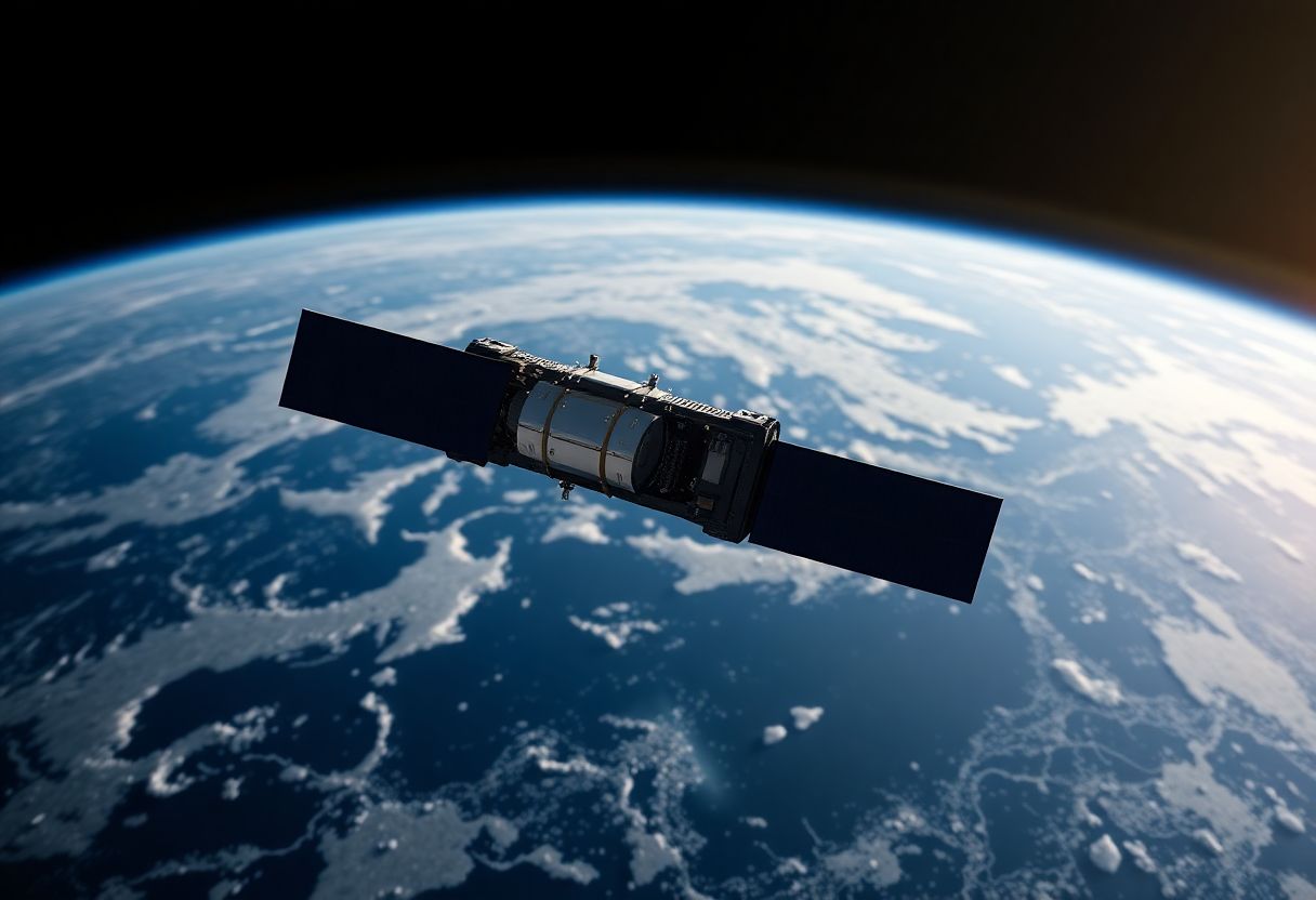
At its core, satellite navigation is a high-tech version of an ancient technique called triangulation. Instead of using landmarks on Earth, we use satellites orbiting high above our planet. The Global Positioning System, developed by the U.S. Department of Defense, is the most well-known of these systems. It consists of a constellation of at least 24 satellites (plus spares) circling the Earth at an altitude of about 20,200 kilometers (12,550 miles).
These satellites, each weighing about 2,000 kg and spanning over 5 meters with their solar panels extended, orbit the Earth twice daily. They're arranged in six orbital planes, ensuring that at least four satellites are visible from any point on Earth at any given time. This arrangement is crucial for the system's global coverage and accuracy.
The Science Behind GPS Positioning
The principle behind GPS positioning is deceptively simple, but its execution requires incredible precision. Here's how it works:
-
Each GPS satellite continuously broadcasts a radio signal containing its location and the exact time the signal was sent. These signals travel at the speed of light – 299,792,458 meters per second in a vacuum.
-
A GPS receiver, like the one in your smartphone, picks up these signals. By measuring the time it takes for the signal to arrive from at least four different satellites, the receiver can calculate its distance from each satellite.
-
Using a mathematical technique called trilateration, the receiver then determines its precise location on Earth, including latitude, longitude, and altitude.
The key to this process is incredibly accurate timing. GPS satellites carry multiple atomic clocks that are precise to within nanoseconds. These clocks use the oscillations of atoms (usually cesium or rubidium) to keep time, with an accuracy of about 1 second in 100,000 years. Even a tiny error in timing can lead to significant positioning errors – a discrepancy of just one microsecond translates to an error of about 300 meters on the ground.
Overcoming Challenges for Precision
Despite its sophistication, GPS technology must overcome several challenges to provide accurate positioning:
Atmospheric Effects
As GPS signals travel through the Earth's atmosphere, they can be delayed or distorted. The ionosphere, a layer of charged particles in the upper atmosphere, can slow down the radio waves. The troposphere, the lowest part of the atmosphere where weather occurs, can also affect signal propagation. Advanced receivers use dual-frequency measurements and atmospheric models to correct for these effects.
Multipath Errors
In urban environments or areas with many obstacles, GPS signals can bounce off buildings, mountains, or other surfaces before reaching the receiver. This phenomenon, known as multipath, can cause positioning errors. Modern receivers use advanced signal processing techniques to identify and mitigate multipath effects.
Satellite Geometry
The arrangement of visible satellites in the sky, known as the geometric dilution of precision (GDOP), can affect positioning accuracy. When satellites are spread out across the sky, the geometry is favorable, leading to more accurate results. Conversely, when satellites are clustered together, accuracy can suffer.
Relativistic Effects
Due to the high speed of the satellites (about 14,000 km/h) and their distance from Earth, Einstein's theories of special and general relativity come into play. The clocks on the satellites tick slightly faster than those on Earth due to these effects. Without accounting for relativity, GPS would accumulate errors of about 10 kilometers per day!
Beyond Navigation: The Many Applications of GPS
While most people associate GPS with turn-by-turn directions in their cars or on their phones, the technology has far-reaching applications across numerous fields:
Scientific Research
GPS has become an invaluable tool for scientists studying the Earth and its systems. Geologists use GPS to measure tectonic plate movements with millimeter-level precision, helping to predict earthquakes and volcanic activity. Meteorologists employ GPS to measure atmospheric water vapor, improving weather forecasts. Biologists track animal migrations using GPS tags, providing insights into wildlife behavior and conservation needs.
Agriculture
Precision agriculture relies heavily on GPS technology. Farmers use GPS-guided tractors and drones to plant seeds, apply fertilizers, and harvest crops with centimeter-level accuracy. This precision reduces waste, increases yields, and minimizes environmental impact. GPS also enables variable-rate application of resources, allowing farmers to tailor their approach to different areas of a field based on soil conditions and crop health.
Transportation and Logistics
Beyond personal navigation, GPS plays a crucial role in the transportation industry. Commercial airlines use GPS for en-route navigation and precision approaches to airports, enhancing safety and efficiency. Shipping companies track their fleets and cargo in real-time, optimizing routes and improving supply chain management. The technology is also fundamental to the development of autonomous vehicles, providing the precise positioning necessary for safe operation.
Emergency Services
GPS has revolutionized emergency response systems. Enhanced 911 services use GPS to quickly locate callers, saving precious time in critical situations. Search and rescue operations rely on GPS to coordinate efforts and locate people in distress, whether in remote wilderness areas or disaster zones.
Time Synchronization
The precise timing provided by GPS is used to synchronize computer networks, financial systems, and power grids around the world. This synchronization is crucial for everything from timestamping financial transactions to coordinating power distribution across electrical grids.
The Global Landscape of Satellite Navigation
While GPS is the most well-known satellite navigation system, it's not the only one. Several other global and regional systems have been developed or are in development:
GLONASS (Russia)
The Global Navigation Satellite System, or GLONASS, is Russia's answer to GPS. Fully operational since 2011, it consists of 24 satellites in three orbital planes. GLONASS uses a different coordinate system and time standard than GPS, but many modern receivers can use both systems together for improved accuracy and reliability.
Galileo (European Union)
Named after the Italian astronomer, Galileo is the European Union's global navigation satellite system. Designed to provide high-precision positioning for civilian use, Galileo offers several service levels, including an encrypted service for government and military applications. When fully deployed, the system will consist of 30 satellites in three orbital planes.
BeiDou (China)
China's BeiDou Navigation Satellite System, named after the Chinese term for the Big Dipper constellation, became fully operational in 2020. It provides global coverage with a constellation of 35 satellites, including both medium Earth orbit and geostationary satellites. BeiDou offers both civilian and military services and is particularly important for China's Belt and Road Initiative.
Regional Systems
In addition to these global systems, several countries have developed or are developing regional navigation satellite systems. These include India's NavIC (Navigation with Indian Constellation) and Japan's QZSS (Quasi-Zenith Satellite System), which provide enhanced coverage and accuracy in their respective regions.
The Future of Satellite Navigation
As technology continues to advance, we can expect satellite navigation systems to become even more precise, reliable, and integrated into our daily lives. Some exciting developments on the horizon include:
Improved Accuracy
Next-generation satellites and ground stations are continually improving the accuracy of positioning systems. For example, the GPS III satellites, currently being launched, offer three times better accuracy than their predecessors and are more resistant to jamming.
Integration with Other Technologies
The fusion of satellite navigation with other technologies is opening up new possibilities. Augmented reality applications, for instance, combine GPS positioning with camera input to overlay digital information on the real world. This has applications in fields ranging from tourism to industrial maintenance.
Indoor Navigation
One limitation of current satellite navigation systems is their reduced effectiveness indoors or in urban canyons where satellite signals are blocked. Research is ongoing into technologies that can seamlessly transition between outdoor and indoor navigation, using a combination of satellite signals, Wi-Fi positioning, inertial sensors, and other techniques.
Quantum Sensors
The development of quantum sensors could revolutionize positioning technology. These sensors, based on the principles of quantum mechanics, could potentially offer orders of magnitude improvement in accuracy and reduce reliance on satellite signals.
Autonomous Systems
As autonomous vehicles become more prevalent, from self-driving cars to delivery drones, the demand for ultra-precise and reliable positioning will only increase. This will drive further innovations in satellite navigation and complementary technologies.
Ethical Considerations and Challenges
While satellite navigation brings numerous benefits, it also raises important ethical and societal questions:
Privacy Concerns
The ability to track individuals' movements with high precision has significant privacy implications. As GPS-enabled devices become ubiquitous, there's a need for robust legal frameworks and ethical guidelines to protect personal privacy while allowing beneficial uses of location data.
Digital Divide
Access to accurate positioning technology is not uniform across the globe. This can exacerbate existing inequalities, particularly in developing regions where mapping may be less comprehensive and GPS-enabled devices less common.
Security Risks
Satellite navigation systems are vulnerable to jamming (blocking signals) and spoofing (sending false signals). As our reliance on these systems grows, so does the potential impact of such attacks. Ongoing research aims to make these systems more robust and secure.
Skill Atrophy
As we become increasingly reliant on GPS for navigation, there's a risk of losing traditional navigation skills. This could be problematic in situations where technology fails or is unavailable.
Conclusion
The Global Positioning System and its counterparts around the world represent one of the most significant technological achievements of the modern era. From its origins as a military technology to its current status as a global utility, satellite navigation has transformed how we understand and interact with our world.
As we look to the future, the continued evolution of these systems promises even greater precision, reliability, and integration into our daily lives. However, as with any powerful technology, it's crucial that we approach its development and use thoughtfully, considering both the tremendous benefits and the potential risks.
The next time you check your smartphone for directions or track a package's journey across the globe, take a moment to appreciate the constellation of satellites orbiting high above, the atomic clocks ticking with incredible precision, and the complex algorithms working in harmony to pinpoint your location on our vast planet. It's a testament to human ingenuity and a reminder of how technology can quite literally help us find our place in the world.